


| Metropolitan Area Weather Alerts |
|
|
 |
| Radar/Satellite images courtesy of Weather Underground. | |
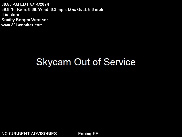
No Weather Records Have Been Established For This Station Today as of 04/25/2024 12:35am
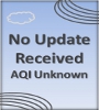
Warning: Undefined array key 1 in /home/weatherc/public_html/get-aqi-rss.php on line 60
Deprecated: strip_tags(): Passing null to parameter #1 ($string) of type string is deprecated in /home/weatherc/public_html/get-aqi-rss.php on line 60
Warning: Undefined array key 2 in /home/weatherc/public_html/get-aqi-rss.php on line 61
Deprecated: strip_tags(): Passing null to parameter #1 ($string) of type string is deprecated in /home/weatherc/public_html/get-aqi-rss.php on line 61
Warning: Undefined array key 3 in /home/weatherc/public_html/get-aqi-rss.php on line 62
Deprecated: strip_tags(): Passing null to parameter #1 ($string) of type string is deprecated in /home/weatherc/public_html/get-aqi-rss.php on line 62
|
METRIC |
IMPERIAL
|
Updated: 04-25-2024 @ 12:35am (0 sec ago) | |||||||||||||||||||||||||||||||||||||||||||||||||||||||||||||||||||||
| Temperature | Current Conditions | Forecast / Storm Prediction | ||||||||||||||||||||||||||||||||||||||||||||||||||||||||||||||||||||
|
|
|
||||||||||||||||||||||||||||||||||||||||||||||||||||||||||||||||||||
| Dew Point | Liquid Precipitation | Wind Speed | Sun/Moon | |||||||||||||||||||||||||||||||||||||||||||||||||||||||||||||||||||
|
|
|
|
|||||||||||||||||||||||||||||||||||||||||||||||||||||||||||||||||||
| Humidity | Barometer | |||||||||||||||||||||||||||||||||||||||||||||||||||||||||||||||||||||
|
|
|||||||||||||||||||||||||||||||||||||||||||||||||||||||||||||||||||||
| Heating Degree Days | Lightning Strikes | Wind Chill | Air | |||||||||||||||||||||||||||||||||||||||||||||||||||||||||||||||||||
|
|
|
|
|||||||||||||||||||||||||||||||||||||||||||||||||||||||||||||||||||
| UV Summary/Forecast | Solar Summary | |||||||||||||||||||||||||||||||||||||||||||||||||||||||||||||||||||||
|
|
|||||||||||||||||||||||||||||||||||||||||||||||||||||||||||||||||||||
| Almanac | Snow3 | Station All Time Records | Cloud Level | |||||||||||||||||||||||||||||||||||||||||||||||||||||||||||||||||||
|
|
|
|
|||||||||||||||||||||||||||||||||||||||||||||||||||||||||||||||||||


| 1 Rain season: Jan 1st to Dec 31st. 2 Snow season July 1st to June 30th. 3 Snow manually measured usually around 7AM and 7PM. 6 Air Quality Index is provided by Minnesota Polution Control Agency and is updated hourly between the hours of 6AM and Midnight. 10 Historical average only to day 25 of just the month of April for this station since 2013. 11 Historical average rain this season to day 25 of April for this station since 2013. |
| NWS Weather Forecast - Outlook Overnight & Thursday | ||||||||||||||
|
||||||||||||||
|
||||||||||||||
|
||||||||||||||
|
ajax-dashboard6.php - Version 6.95h - 20-Feb-2023 - Script by: Scott of BurnsvilleWeatherLIVE.com Now supported by Saratoga-weather.org Download |
||||||||||||||


