197
FXUS61 KOKX 230845
AFDOKX

Area Forecast Discussion
National Weather Service New York NY
345 AM EST Sun Feb 23 2025

.SYNOPSIS...
High pressure remains in control today and moves offshore
tonight into Monday. A weak cold front moves through late
Tuesday into Tuesday night. Weak high pressure briefly returns
Wednesday before a quick moving frontal system likely affects
the region Wednesday might into Thursday. This will be followed
by a series of cold fronts passing through the region Friday
into the weekend.

&&

.NEAR TERM /UNTIL 6 PM THIS EVENING/...
Surface high pressure builds over the region today behind a
departing trough well to the north. With nearly zonal upper flow
a weak shortwave approaches late in the day and will bring some
mid and high level moisture. High temperatures will be near
normal levels, and used a blend of the MOS and NBM guidance.

&&

.SHORT TERM /6 PM THIS EVENING THROUGH TUESDAY/...
An upper level shortwave passes through the northeast tonight
with mid and high level moisture, while at the surface high
pressure gradually moves offshore. Weak warm advection sets up
late tonight with a light flow through the boundary layer. With
the cloud cover limiting radiational cooling and the weak warm
advection overnight lows will be near or just above normal.

Monday a return flow sets up with increasing low level warm
advection into Monday night. Monday`s temperatures will be above
normal especially inland. However, with the southerly flow over
cooler ocean waters, highs along the coast may fall short of the
forecast highs. Clouds increase Monday night as yet another more
amplified shortwave moves quickly across the northern tier and
through the northeast Tuesday. With the warmup continuing and
cloud cover temperatures will be 5 to near 10 degrees above
normal. Little frontal forcing and limited moisture, with the
lower levels remaining dry, will keep slight chance
probabilities, and with the warm air any precipitation that does
occur will be all liquid.

&&

.LONG TERM /TUESDAY NIGHT THROUGH SATURDAY/...
Key Points:

* Temperatures will likely run 5 to 10 degrees above normal
  Wednesday and Thursday. A return to more seasonable temps for
  Fri/Sat, and possibly below normal to end the weekend.

* Mainly dry conditions are expected through mid week. A quick
  moving frontal system will likely affect the region Wed Night into
  Thursday.

Following a passing cold front from a passing low to our north,
Tuesday night will trend drier with decreasing clouds. Winds will be
mainly light from the NW. Given the light NW flow and skies becoming
clear, some radiational cooling may take place cooling many into the
upper-30s to around 30. NW flow will continue into Wednesday morning
before turning west Wednesday afternoon, then eventually back to SW
Wednesday night. Temperatures will continue to be several degrees
above seasonable levels Wednesday through Thursday.

Thereafter, general model agreement in further longitudinal
amplification of troughing across the Eastern US for late week
period in response to a more vigorous PAC shortwave diving through
the Central US into the southern Mid Atlantic. ECE and GEFS coming
into better agreement with this trough amplitude/timing, and
depicting a progressive and mild frontal system moving through the
region Thu/Thu night. A shot of Canadian air and return to more
seasonable temps on Friday, with perhaps a few rain/snow showers as
trough axis moves through early on Friday.

Better general agreement in polar troughing exerting more influence
on the NE US for the second half of the weekend into early next
week, in wake of a clipper system tracking through southern
Ontario/Quebec and northern New England on Saturday. This clipper
system could bring another chance for rain/snow. The polar trough
would signal a return to below normal temps during this time
period.

&&

.AVIATION /09Z SUNDAY THROUGH THURSDAY/...
VFR as high pressure remains centered to our south through this
evening, moving offshore overnight and into early Monday.

SW winds around 10 kt or less through early this morning. Many sites
may be variable until a few hours after daybreak. The direction
becomes W after daybreak with speeds around 10 kt through the
afternoon. Winds diminish in the evening, becoming light and
variable and remain so into tonight.

 ...NY Metro (KEWR/KLGA/KJFK/KTEB) TAF Uncertainty...

Wind speeds may be a few kt higher at times through 09z at KJFK,
KLGA, and KEWR.

.OUTLOOK FOR 09Z MONDAY THROUGH THURSDAY...

Monday: VFR.

Tuesday: Mainly VFR. Slight chance of afternoon and evening showers
and MVFR.

Wednesday: VFR.

Thursday: Rain showers and MVFR possible. Mixed rain/snow showers
possible at KSWF.

Detailed information, including hourly TAF wind component forecasts,
can be found at: https:/www.weather.gov/zny/n90

&&

.MARINE...
The pressure gradient remains weak today through Monday with
high pressure in control. With the high moving offshore Monday
into Monday night, and with the approach of a weak cold front,
southerly winds will increase late Monday into Monday night.
With warmer air moving over the cold ocean waters during this
time mixing will be limited with gusts also limited, with gusts
nearing 25 kt for a brief period Monday night. A weak cold front
crosses the waters late Tuesday into Tuesday night.

Winds and seas remain below advisory levels across the forecast
waters today through Tuesday.

Sub SCA conds continue Tue Night into Wed as weak high pressure
builds. SCA criteria is not expected to be met through the
start of the weekend.

&&

.HYDROLOGY...
No hydrologic impacts are expected through the end of the week.

&&

.OKX WATCHES/WARNINGS/ADVISORIES...
CT...None.
NY...None.
NJ...None.
MARINE...None.

&&

$$

SYNOPSIS...BR/MET
NEAR TERM...MET
SHORT TERM...MET
LONG TERM...BR
AVIATION...BR
MARINE...BR/MET
HYDROLOGY...BR/MET

35°F
Serving the New York City Metro Area, USA 
Updated:
02-18-2025 12:15am

Live Updates Error: clientraw.txt file has not been updated for 125 hours, 48 minutes.
We are currently fixing technical difficulties. Live updates will resume soon.
Navigation
- Home
- Mini Home
- School Closings
- Snow Totals
- Beach Reports
- Lightning
- Radar
- Satellite
- Forecast & Advisories
- Almanac
- Station History
- Station Graphs
- Weather Maps
- Severe Wx
- Webcam
- Air Quality
- Live Gauges
- Vue Console
- Virtual Window
- Drought Monitor
- River Flooding
- Buoy Stations
- Hurricanes
- Weather Extremes
- Links
- About
- Wx Stickers
- Printable Flyer
- Status
- Alert Signup
- RSS Feeds

- Mobile

- Contact Us
- Website Map
External Links
Style Options
Alerts
Wx Extremes
| USA |
| High Temp |
| 99°F at Terrel County Arpt Aso, TX |
| Low Temp |
| 1°F at Clayton Lake, ME |
| Precipitation |
| 1.55in at Oceana/Nas Soucek Fld, VA |
Tell a friend!
Click to print our business card.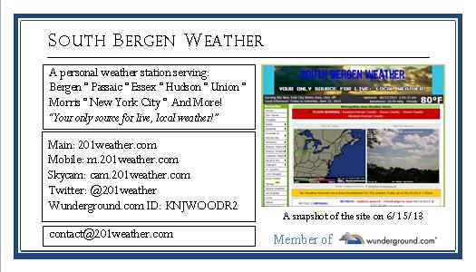
Affiliations


© 2012-2019 South Bergen Weather |
Weather-Display (10.37S-(b152)) |
Terms of Service |
Privacy Policy

 Some items ©Wunderground. Excluded from copyright. Used with permission.
Some data is provided from a weather station that is not officially recognized for reporting, and while we strive to maintain accuracy, it is important you do NOT depend on our data. Likewise, we maintain no responsibility for damages that occur when using information from this site. Use of this site signifies your acceptance of the Terms of Service and Privacy Policy.
Some data is provided from a weather station that is not officially recognized for reporting, and while we strive to maintain accuracy, it is important you do NOT depend on our data. Likewise, we maintain no responsibility for damages that occur when using information from this site. Use of this site signifies your acceptance of the Terms of Service and Privacy Policy.
Advertisement